
“Procuring our enterprise drone survey rigs through Fanrum cut our site turnaround in half. Their support verified RTK base station compatibility before shipping, and signature freight delivery was flawless.”

FR-WINGTR-46607135637752
•
Serial Logged Dispatch
•
256-Bit Encrypted
 Verified Fit
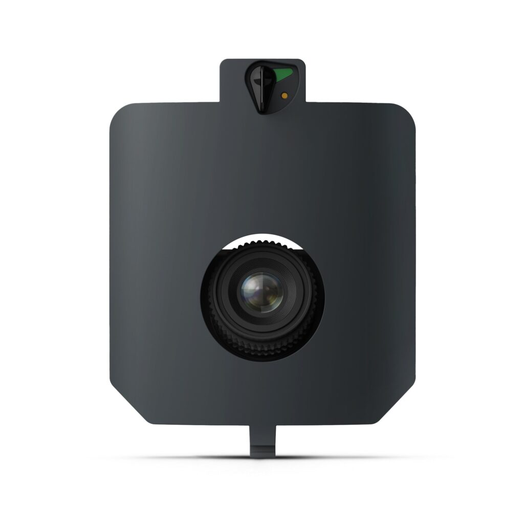
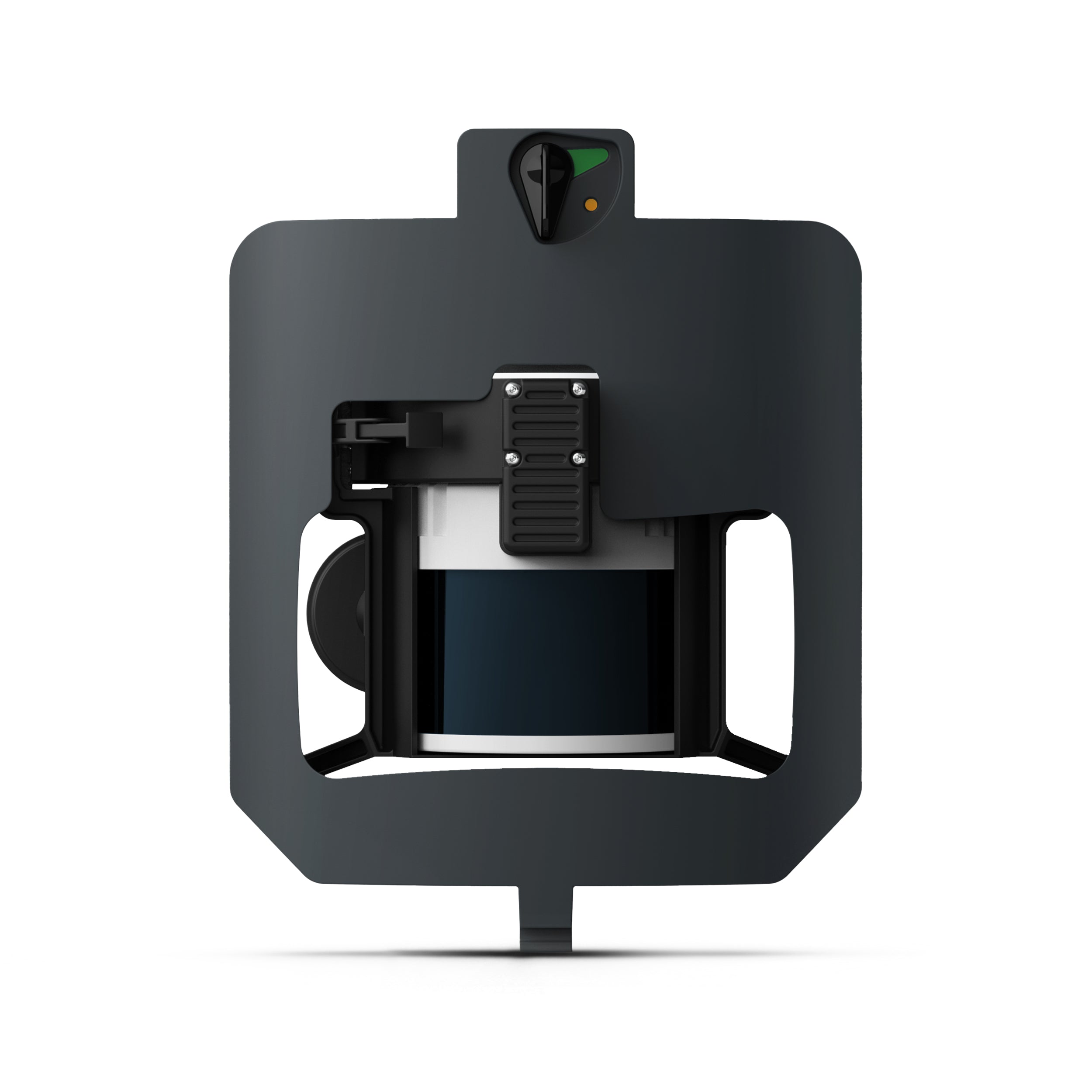
The WingtraRAY LiDAR payload penetrates dense canopy to capture sub-meter elevation detail for mining, construction, urban-planning, and environmental surveys. Deliver vertical RMS accuracy down to 3 cm / 1.2 in and achieve point densities up to 200 pts/m², all within Wingtra’s streamlined VTOL and WingtraCLOUD workflow.
Detailed technical architecture and verified subsystem metrics.
FR-WINGTR-46607135637752
| Scanner | Hesai XT32M2X rotating sensor • 905 nm • ≤ 300 m range |
| Payload weight (incl. mount) |
1 060 g (2.34 lb) |
| Point density @ 150 ft (45 m) | 110 pts/m² (single) — up to 660 pts/m² (triple)* |
| Point density @ 300 ft (90 m) | 110 pts/m² (hard surface) — up to 330 pts/m² (triple) |
| Point density @ 400 ft (120 m) | 84 pts/m² (hard surface) — up to 252 pts/m² (triple) |
| Coverage with PRS* | 150 ft: 220 ha (545 ac) • 300 ft: 415 ha (1 025 ac) |
| Coverage w/o PRS* | 150 ft: 245 ha (605 ac) • 300 ft: 460 ha (1 140 ac) |
| Vertical accuracy (RMS) | ≤ 3 cm (1.2 in) @ 300 ft |
| IMU | Inertial Labs tactical-grade (0.006° roll/pitch) |
| Outputs | Corrected LAS / LAZ point clouds via Wingtra LiDAR App |
| *Assumptions | 30 % side-overlap, calm conditions |
Complete unboxing checklist and verified included components.
(1) Wingtra LiDAR payload module
(1) Wingtra LIDAR Usage License
(1) Quick-lock nadir mount (pre-installed)
(1) Protective transit bracket
(1) Payload transport sleeve
(1) Quick-start & safety guide
(1) LiDAR Perpetual license plus 3 years of updates & support
WingtraRAY
Fanrum Electronics operates strict chain-of-custody protocols for all high-ticket commercial hardware orders.
All orders over $500 automatically receive complimentary insured commercial freight with mandatory adult signature delivery upon arrival. Shipments are double-cartoned, strapped, and dispatched with tamper-evident serial logging to guarantee complete chain-of-custody.
All UAV and aerial mapping platforms are verified for FAA Remote ID certification and relevant NDAA compliance standards. Hardware is sourced exclusively through authorized North American distributors with verifiable serial pedigrees.
In-stock units dispatch directly from our centralized distribution facility within 24 hours of payment clearance. Standard commercial courier transit times range between 3 to 5 business days across the contiguous 48 United States.
Commercial operators have 30 days from courier delivery to verify unit functionality, calibration values, and accessory integrity. Defective hardware is replaced immediately under our direct concierge priority warranty queue.
Direct operational answers from our technical hardware team.
Don’t just take our word for it—see what our customers have to say about their experience!
“Procuring our enterprise drone survey rigs through Fanrum cut our site turnaround in half. Their support verified RTK base station compatibility before shipping, and signature freight delivery was flawless.”
“Our cinema camera production bundle and high-capacity flight batteries operate without a single glitch on remote shoots. Insured signature freight arrived directly to our studio within 48 hours.”

“On commercial cinema sets, equipment failure costs thousands per hour. Fanrum walked us through anamorphic lens dovetails and delivered factory-sealed Leica packages on urgent notice.”

“Our dual-sensor drone inspection kits arrived double-boxed with factory calibration intact. Exceptional technical communication and prompt tracking updates from day one.”

“The commercial drone fleet and thermal imaging payload kits we ordered for our field survey team exceeded expectations. Built like absolute tanks and customer care handled tax-exempt invoicing in minutes.”

“We’ve sourced thermal sensor payloads and commercial UAVs from several vendors, but Fanrum’s delivery speed and zero-friction freight handling make them our preferred partner.”

“Enterprise drone surveying and payload integration are mission-critical for our operations. Fanrum’s desk verified RTK base station compatibility and shipped within 24 hours.”

“Ordered multiple cinema mirrorless cameras and optical packages for our studio production. Pristine condition, insured signature freight, and helpful tracking updates throughout the entire transit.”

Direct access to our Little Rock, AR engineering desk. Invoices issued within 2 business hours.